Traditional Inertial Navigation Systems (INS) have always been limited by drift accumulation—even the most precise gyroscopes and accelerometers eventually lose accuracy over time. No single sensor, no matter how advanced, can maintain reliable positioning when GNSS is denied. Today, multi-sensor fusion—integrating IMUs with GNSS, vision, LiDAR, underwater sonar and more—has redefined INS, delivering lower drift, stronger anti-jamming resilience, and seamless performance across diverse operational environments.
Multi-sensor fusion is redefining Inertial Navigation Systems by combining IMUs, GNSS, vision, LiDAR, sonar, and more into a unified solution. This approach dramatically reduces drift, enhances positioning in GNSS-denied environments, and delivers resilient, mission-ready navigation for defense, aerospace, and autonomous platforms operating across air, land, sea, and space.
In modern INS, precision comes from combining multiple sensors and using smart algorithms to deliver reliable navigation in any environment.
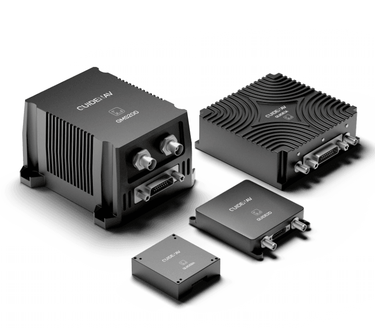
Table of contents
What Is Multi-Sensor Fusion in the Context of INS?
Multi-sensor fusion in Inertial Navigation Systems (INS) is the process of integrating data from multiple navigation sources—such as IMUs, GNSS, vision, LiDAR, and barometers—into a single, optimized solution. By combining complementary strengths and compensating for individual weaknesses, fusion delivers more accurate, robust, and continuous navigation than any single sensor could achieve on its own.
For example, an INS might combine:
- MEMS/FOG gyroscopes and accelerometers for short-term motion sensing.
- GNSS receivers for absolute position fixes.
- Vision systems or LiDAR for feature-based localization.
- Barometers for altitude stability.
- Sonar for underwater positioning and obstacle detection.
The fusion is handled by algorithms like Extended Kalman Filters (EKF), factor graph optimization, or deep learning-based estimators.
Why Does an INS Need Sensor Fusion at All?
Pure inertial systems drift because sensor errors integrate over time—even a 0.01°/hr gyro bias can cause significant position errors in hours. GNSS can correct drift but fails under jamming, multipath, or indoor conditions.
By integrating multiple sensors, an INS can:
- Bound drift growth by cross-checking motion estimates against other data sources.
- Maintain continuous navigation during GNSS outages, jamming, or spoofing.
- Improve reliability in dynamic environments such as urban canyons, tunnels, or indoor spaces.

What Are the Key Sensors Used in Modern Fusion-Based INS?
Modern multi-sensor INS solutions rely on a combination of complementary technologies, each addressing specific weaknesses of the others. By integrating these sensors, the system achieves higher accuracy, greater resilience, and better adaptability across air, land, sea, and space operations.
| Sensor Type | Primary Function | Key Advantage in Fusion |
|---|---|---|
| IMU (MEMS or FOG) | Measures acceleration and angular rate | Core motion sensing with high update rates |
| GNSS (single or multi-frequency) | Provides absolute position, velocity, and timing | Corrects drift and anchors navigation to global coordinates |
| Vision systems (monocular, stereo, event cameras) | Visual odometry and mapping | Enables navigation in GNSS-denied environments |
| LiDAR | Generates 3D point clouds of surroundings | Accurate obstacle detection and terrain mapping |
| Magnetometer | Measures magnetic field for heading | Stabilizes heading and corrects gyro drift |
| Barometer | Detects air pressure changes | Smooth altitude estimation and vertical positioning |
| Radar/Sonar | Detects objects using radio or sound waves | Effective in low-visibility or underwater environments |

How Does Sensor Fusion Actually Work?
In a multi-sensor INS, fusion algorithms continuously evaluate incoming data from all sensors and decide how much weight to assign to each source at any given moment. This dynamic adjustment ensures smooth, accurate navigation even when some sensors become unreliable due to environmental conditions or interference.
| Scenario | Primary Sensor Contribution | Fusion Adjustment |
|---|---|---|
| Open sky with strong GNSS signal | GNSS dominates for position; IMU smooths motion | High weight on GNSS, lower on vision/LiDAR |
| Tunnel or urban canyon | Vision or LiDAR takes over for positioning | Reduced GNSS weight, higher reliance on vision/LiDAR and IMU |
| High-speed aerial maneuver | IMU provides rapid motion updates | GNSS corrects drift; fusion balances short-term IMU data with GNSS fixes |
| GPS jamming or spoofing | IMU, vision, and magnetometer maintain navigation | GNSS input minimized or ignored |
| Low-visibility maritime operation | Radar/Sonar handles obstacle and position cues | Fusion combines radar/sonar with IMU and GNSS where available |
What Are the Main Benefits of Multi-Sensor INS?
By combining complementary navigation sources, multi-sensor fusion transforms a standard inertial navigation system into a far more capable and resilient platform. This integration not only addresses the weaknesses of individual sensors but also unlocks performance levels that are critical for defense, aerospace, and autonomous operations.
- Reduced Drift Over Time– Cross-verifying motion data between sensors slows error accumulation, extending mission accuracy.
- GNSS-Denied Performance– Maintains reliable navigation during jamming, spoofing, or signal loss by relying on alternative sensors.
- Cross-Environment Adaptability– Operates effectively across air, land, sea, and underground scenarios without major recalibration.
- Real-Time Fault Detection– Identifies and isolates faulty sensors before they degrade navigation output.
- Seamless User Experience– Delivers stable, smooth position and heading updates without sudden jumps or dropouts.
Where Is Multi-Sensor INS Being Used Today?
The flexibility of multi-sensor fusion allows modern inertial navigation systems to operate in environments and scenarios that were once impossible for stand-alone sensors. From combat zones to autonomous exploration, the technology has proven itself across multiple domains.
- Defense & Military Operations– Armored vehicles, UAVs, and artillery systems use fusion-based INS to maintain precise positioning in GPS-jammed battlefields.
- Autonomous Vehicles– Self-driving cars rely on fusion to navigate urban canyons and tunnels where GNSS signals are unreliable.
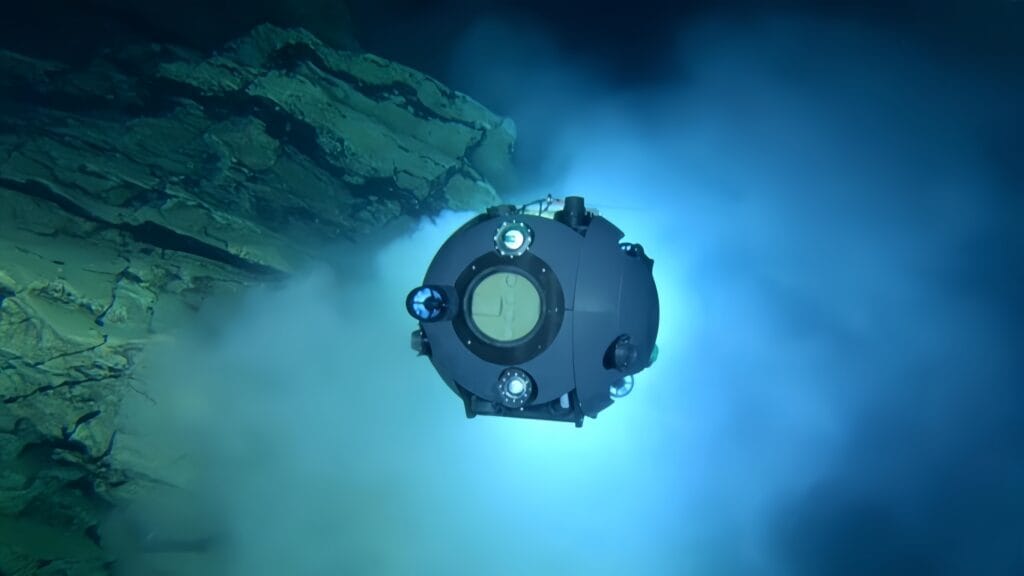
- Maritime Navigation– Ships and submarines integrate radar, sonar, and INS for safe operation in GNSS-denied harbors and underwater missions.
- Aerospace Applications– Aircraft and spacecraft use fusion for accurate attitude control and orbital maneuvers, even beyond GNSS coverage.
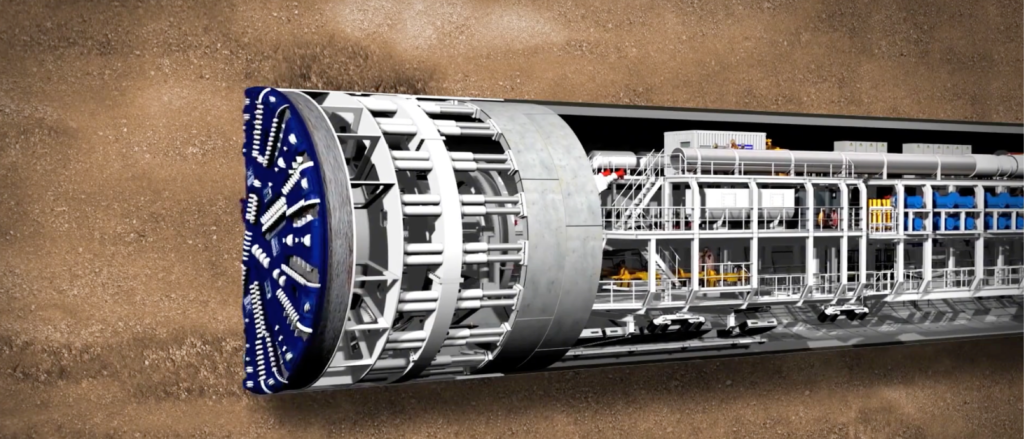
- Surveying & Mapping– Fusion-based systems enable precision mapping under dense canopy, indoors, or in underground facilities.
How Does Sensor Fusion Handle Conflicting Data?
When different sensors in an inertial navigation system provide conflicting information, fusion algorithms apply strategies to maintain accuracy and stability:
- Dynamic Weighting– Reduces the influence of sensors that appear unreliable under current conditions.
- Outlier Detection– Identifies and removes sudden spikes or abnormal readings before they corrupt the solution.
- Cross-Sensor Validation– Compares results from multiple sensors to confirm accuracy before output.
- Fallback Modes – Automatically switches to alternative navigation methods if a primary sensor fails.
What Challenges Remain in Multi-Sensor INS?
Building a multi-sensor inertial navigation system often feels like solving a puzzle where every piece must fit perfectly. The first hurdle is aligning each sensor in time and space—even millisecond delays can distort position estimates. Then comes the computing burden of processing vast streams of data in real time without introducing latency. Engineers must also balance SWaP constraints, ensuring the system stays compact and efficient for its platform. Beyond the hardware, the fusion logic must be intelligent enough to spot bad data before it contaminates the solution. And in the field, unpredictable environmental factors—from GPS jamming to heavy fog—test whether the system can adapt without losing accuracy.
How Does GuideNav Leverage Multi-Sensor Fusion?
At GuideNav, our multi-sensor inertial navigation systems are built to overcome the toughest operational challenges through:
Integrated Tactical-Grade Sensors – Combining MEMS and FOG IMUs with GNSS, magnetometers, and optional vision/LiDAR modules.
Low-Latency Fusion Algorithms – Optimized for real-time performance in defense, aerospace, and industrial autonomy.
SWaP-Optimized Designs – Compact, lightweight, and power-efficient without sacrificing precision.
ITAR-Free Compliance – Ensuring smooth, unrestricted global deployment.
Mission-Proven Reliability – From UAVs in GPS-denied zones to autonomous vehicles in tunnels and ships navigating in zero visibility.