In modern navigation—whether on battle tanks, submarines, or UAVs—confusion often arises between FOG north finders and FOG inertial navigation systems (INS). Both rely on fiber optic gyroscope technology, yet they are not the same. Misunderstanding their differences may lead to overpaying for features you don’t need—or worse, under-specifying a solution and risking mission failure. Understanding this difference is essential for engineers and procurement officers alike.
No, a FOG north finder and a FOG INS are not the same. A north finder provides true heading using Earth’s rotation, while a FOG INS delivers full navigation data—position, velocity, and attitude—through gyroscopes, accelerometers, and navigation algorithms.
Both devices share the fiber optic gyroscope (FOG) as their sensing core. However, their scope of function is very different. One is a specialist heading tool, the other a complete navigation backbone. Let’s explore how they compare.
Table of contents
What Is a FOG North Finder?
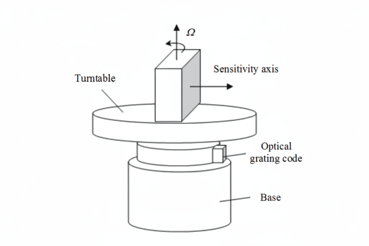
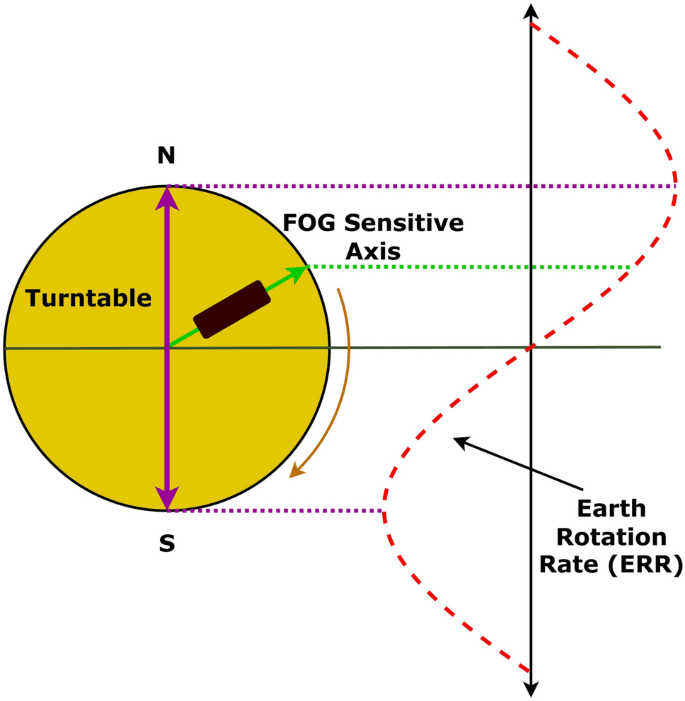
A FOG North Finder, also known as a fiber optic gyrocompass, is designed to deliver true north heading by measuring Earth’s rotation with a fiber optic gyroscope. Its greatest advantage lies in being immune to magnetic interference, providing a level of reliability that magnetic compasses or GNSS-based heading cannot match.
- Key Outputs: True heading (sometimes pitch and roll).
- Strengths: High precision, fast alignment, and stable performance in environments where magnetic or GPS signals are unreliable.
- Applications: Artillery alignment, radar pointing, antenna orientation, and geodetic surveying.
In essence, a FOG north finder is a trusted heading reference—compact, accurate, and dependable in challenging environments.
What Is a FOG INS?
A FOG Inertial Navigation System (INS) is a complete navigation solution that combines three-axis fiber optic gyroscopes with three-axis accelerometers and advanced algorithms. Unlike a north finder, it does more than heading—it continuously calculates position, velocity, and attitude (PVA) in real time.
- Key Outputs: Position, velocity, heading, pitch, and roll.
- Strengths: Works in dynamic motion, delivers continuous navigation without GPS, and resists jamming or signal loss.
- Applications: UAVs, submarines, battle tanks, and spacecraft where mission success depends on uninterrupted navigation.
In short, a FOG INS is a complete navigation backbone—powerful, independent, and indispensable for GPS-denied environments.
How Are They Similar?
Although a FOG North Finder and a FOG INS serve different purposes, they share several core strengths that explain why both are trusted in critical missions:
Shared Core Components
Both systems are built around the same core sensors—fiber optic gyroscopes for angular velocity and accelerometers for linear motion. The difference lies in how much data they process and output.
Immunity to Magnetic Disturbances
Unlike magnetic compasses or magnetometer-based heading sensors, both systems are unaffected by nearby steel structures, electromagnetic fields, or magnetic anomalies. This makes them dependable in environments such as military bases, naval vessels, or urban canyons where traditional compasses fail.
Operation in GPS-Denied Environments
Both devices deliver reliable navigation or orientation data without relying on external signals. This makes them essential in electronic warfare zones, subterranean operations, or underwater missions where GPS simply cannot reach.
Proven Military and Industrial Adoption
Whether mounted on tanks, artillery systems, submarines, or surveying equipment, both north finders and INS units have been field-proven to deliver consistent accuracy under harsh conditions. Their rugged design and compliance with MIL-STD-810 and similar standards make them suitable for extreme temperatures, shocks, and vibrations.
In short, both FOG-based devices are built on the same precision gyroscope foundation and excel in environments where other navigation methods fall short—the main difference lies in how much they do with that foundation.
How Are They Different?
While both are built on fiber optic gyroscope technology, a FOG North Finder and a FOG INS differ greatly in scope, complexity, and output.
| Aspect | FOG North Finder | FOG INS |
|---|---|---|
| Core Purpose | Finds true north heading | Provides full navigation (PVA) |
| Sensors | 1–3 gyroscopes | 3 gyros + 3 accelerometers |
| Outputs | Heading, sometimes pitch/roll | Position, velocity, heading, pitch, roll |
| Initialization | Requires static or semi-static setup | Works in dynamic motion |
| Complexity | Simple, easy to operate | Advanced, requires algorithms and filters |
| Cost | Lower | Higher |
| Applications | Artillery alignment, radar pointing, surveying | UAVs, submarines, tanks, aircraft |
Why These Differences Matter
A north finder is essentially a specialized compass replacement: cheaper, faster to deploy, and ideal when you only need heading data.
A FOG INS, by contrast, is a complete navigation system: it requires more sensors, processing power, and calibration, but delivers far richer outputs and is indispensable for long-term, GPS-independent missions.
In procurement terms, choosing incorrectly can mean paying ten times more for features you don’t need—or buying a device that falls short of mission requirements.
The takeaway: a north finder is about orientation, while an INS is about navigation.
Why the Confusion?
The distinction between a FOG North Finder and a FOG INS is not always obvious to engineers, buyers, or even system integrators. Because both devices rely on fiber optic gyroscopes and sometimes share overlapping functions, many people mistakenly treat them as the same type of navigation equipment. Below are the key reasons why this confusion often arises:
Overlapping Functions
- INS units often include a north-finding modefor alignment.
- Some north finders provide pitch and roll, creating the illusion of a full INS.
Similar Terminology
- Terms like gyrocompass, north finder, and INSare sometimes used loosely.
- Buyers may assume they refer to the same class of device.
Partial Integration
- A north finder is sometimes integrated into a larger navigation system.
- Users mistake the modulefor the entire INS.
Marketing Blur
- Vendors may overstate the functions of a north finder or simplify INS capabilities.
- Technical brochures sometimes highlight only heading or orientation, hiding the broader scope of INS.
User Assumptions
- To many non-specialists, “anything with a FOG” sounds like a complete navigation system.
- In truth, the same gyro core can serve very different purposes.
Which One Should You Choose?
The decision between a FOG North Finder and a FOG INS depends entirely on what your platform needs to achieve. Each has clear advantages in specific scenarios:
When a FOG North Finder Is the Better Choice
- Heading Alignment Only: Ideal when you only need a precise true north reference.
- Static or Semi-Static Use: Works best in surveying, artillery setup, or radar alignment.
- Lower Cost and Simplicity: A more economical option when continuous navigation is not required.
When a FOG INS Is the Right Solution
- Full Navigation Data: Provides position, velocity, and attitude continuously.
- Dynamic Operations: Essential for UAVs, tanks, submarines, or spacecraft in motion.
- GPS-Denied Environments: Maintains reliable navigation even when signals are jammed or unavailable.
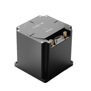
GUIDENAV North Finders: Trusted Accuracy Down to 0.03°
A FOG North Finder and a FOG INS share the same gyroscope foundation, but serve very different roles—one is a specialized heading reference, the other a complete navigation backbone. Among GuideNav’s portfolio, the GFS20 Series Fiber Optic INS stands out as one of our best-selling solutions, trusted by defense, aerospace, and industrial customers worldwide.
What makes GuideNav FOG North Finder Series exceptional is its industry-leading north-seeking accuracy of up to 0.03°, combined with high-precision three-axis fiber optic gyroscopes, quartz accelerometers, and multi-constellation GNSS. This advanced integration ensures rock-solid heading, velocity, and position data across land, air, and marine environments—even under GPS-denied conditions.