Lost or degraded GNSS signals in complex environments such as urban canyons, underground tunnels, or dense forests can cause critical navigation failures, risking mission success and safety. As an expert in inertial navigation, I will explain how INS solutions, leveraging advanced sensors and intelligent algorithms, address these challenges to provide reliable, precise navigation where conventional methods falter.
Inertial Navigation Systems (INS) operate independently of external signals by measuring acceleration and angular velocity through internal sensors, making them indispensable in environments where GNSS signals are blocked or unreliable. Through sophisticated sensor fusion, error compensation, and AI-driven corrections, INS delivers continuous, accurate positioning in the most demanding scenarios.
Let me guide you through the fundamental principles, key technologies, and cutting-edge developments that empower INS to overcome complex navigation challenges.
Table of contents
Why Are Inertial Navigation Systems Crucial for Complex Environments?
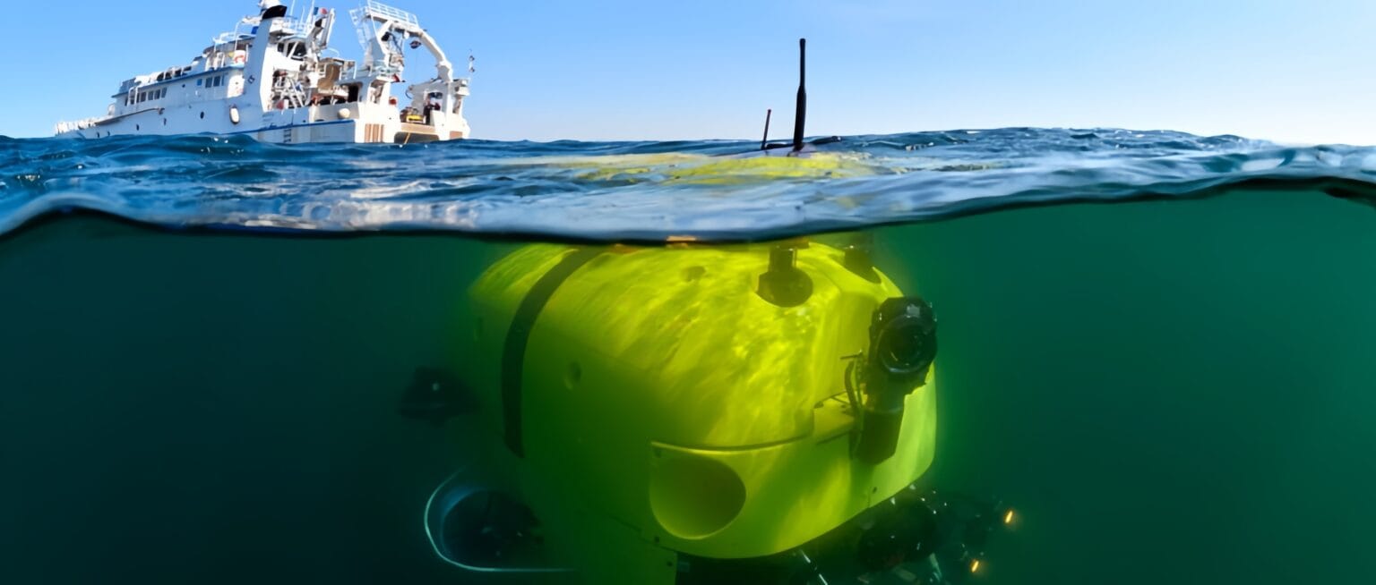
Complex environments—urban canyons with signal multipath, underground tunnels with no satellite visibility, and dense forests with signal blockage—pose severe challenges. These environments degrade or eliminate GNSS signals, causing positioning errors or outages. From my experience and extensive study, inertial navigation systems (INS) are foundational to modern autonomous navigation, especially where external signals like GNSS are compromised. INS uses inertial measurement units (IMUs) to track motion by measuring accelerations and rotations, enabling self-contained navigation. This article explores how INS technology, combined with advanced algorithms and sensor fusion, addresses these challenges to maintain navigation accuracy and robustness.
What Are the Main Navigation Challenges in Complex Environments?
In my work with navigation system integration, I’ve consistently found that traditional positioning methods don’t hold up in the field. It’s not just about having a map or GNSS access—real-world environments introduce obstacles that quickly expose system weaknesses. Open skies are one thing; but once we move into urban canyons, dense vegetation, underground zones or underwater, accurate navigation becomes much harder to maintain.
To build systems that actually perform under these conditions, we need to understand exactly why and where conventional methods fail. Navigating in complex environments confronts several critical issues:
1. Signal Blockage and Multipath Effects:
Tall buildings, underground structures, and dense foliage block or reflect GNSS signals, causing positioning errors or loss.
2. Dynamic Environmental Changes:
Changes like vegetation growth or construction alter surroundings, leading to mismatches between sensor data and maps.
3. Sensor Noise and Drift Accumulation:
INS sensors inherently accumulate errors over time, causing drift without external correction.
4. Environmental Interference:
Magnetic field variations, mechanical vibrations, and temperature changes affect sensor accuracy and system stability.
5. Deliberate Jamming and Spoofing:
In high-risk or contested areas, GNSS signals may be intentionally jammed or spoofed, making satellite-based positioning unreliable or deceptive.
These factors combine to degrade navigation reliability, especially when relying solely on GNSS.
How Does INS Work and Why Is It Suitable for Complex Environments?
Many still believe that once GNSS signals are lost, navigation becomes impossible. But that’s only true if your system depends entirely on satellites. In practice, that’s where Inertial Navigation Systems (INS) step in—and thrive.
Unlike GNSS, an INS doesn’t rely on external references. It uses internal motion sensors—high-precision accelerometers and gyroscopes—to continuously track movement. By integrating this data, the system calculates its position, velocity, and orientation in real time. No signals. No satellites. Just physics.
That’s exactly why I trust INS in the field—especially in GPS-denied environments like tunnels, underground facilities, dense forests, or contested zones. The system keeps working where others fail, delivering high-frequency updates and uninterrupted navigation.
What Are the Key INS Technologies and Techniques to Overcome These Challenges?
Of course, INS isn’t perfect—it accumulates drift over time. But when integrated with GNSS, LiDAR, or vision-based corrections, it becomes part of a resilient, hybrid navigation system—ideal for complex and unpredictable environments where uptime and autonomy are critical.
To overcome INS drift and long-term accuracy loss, modern systems pair robust hardware with intelligent correction algorithms. In my experience, the most reliable solutions fuse multiple sensors with adaptive logic. The table below highlights key methods used to enhance INS performance in GNSS-denied or dynamic environments.
| Technique | Function | Benefit in Complex Environments |
|---|---|---|
| High-Precision IMUs | Use of FOG or low-drift MEMS sensors | Improves baseline accuracy and reduces sensor noise |
| Sensor Fusion | Integration with GNSS, vision, LiDAR, radar via EKF and similar algorithms | Compensates for drift, maintains navigation when external signals fail |
| Error Modeling & Compensation | Methods like ZUPT and complementary filters | Resets accumulated errors during known stationary events |
| Adaptive Filtering & ML | Use of deep learning to dynamically model and correct navigation errors | Enhances robustness and accuracy beyond traditional filter-based systems |
How Has Guidenav Implemented INS Solutions for Complex Environments?
At GuideNav, we’ve proven that reliable navigation doesn’t end when GNSS fails. Here’s how our solutions perform in the real world:
1. Underground Mining Vehicles
In deep underground tunnels where GNSS is completely blocked, our GFS120B ensures stable navigation through pure inertial performance. It offers a heading accuracy of ≤0.02° (no GNSS) and maintains ≤0.003°/h drift during long operations, making it ideal for high-vibration, zero-signal mining environments.
2. UAVs in Forested Terrain
For UAVs flying under canopy or between buildings, the GFS75B delivers 0.02° heading accuracy (dynamic) and RTK positioning within 1 cm. It keeps orientation and position reliable even during aggressive maneuvers or brief GNSS dropouts.
3. Smart Vehicles in Urban Canyons
Autonomous vehicles often lose satellite lock in tunnels or among tall buildings. The GFS90B and GFS120B provide ≤0.015° kinematic heading accuracy and ≤0.005°/h attitude holding, ensuring reliable path tracking even in signal-multipath urban conditions.
4. Defense Systems in GNSS-Denied Battlespace
In GNSS-denied battlefields, the GFS120B delivers tactical-grade navigation with ≤0.003°/h drift, ≤0.02° heading accuracy, and RTK positioning to 1 cm. It’s ideal for armored vehicles, missile systems, and mobile command units operating under jamming and extreme conditions.
GuideNav‘s philosophy is simple: real performance requires real testing. That’s why we tune both hardware and software under field conditions—not just in simulations.
What Are the Future Trends in INS for Complex Environment Navigation?
Looking ahead, several promising trends will further improve INS capabilities:
Intelligent Sensor Fusion and Autonomous Navigation: Increasing integration of heterogeneous sensors with AI-driven decision-making will enable more autonomous and adaptive navigation systems.
Quantum Inertial Sensors: Emerging quantum technologies promise unprecedented precision and near-zero drift, revolutionizing INS performance.
5G and Edge Computing: High-speed communication and edge processing will facilitate real-time data fusion and navigation optimization, even in remote or complex environments.
Green and Low-Power Designs: Energy-efficient INS architectures will support long-duration unmanned missions with minimal power consumption.
These developments will expand INS applicability and reliability in increasingly challenging scenarios.